

Features Coastal Navigation
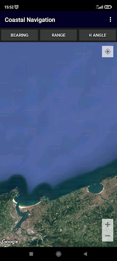
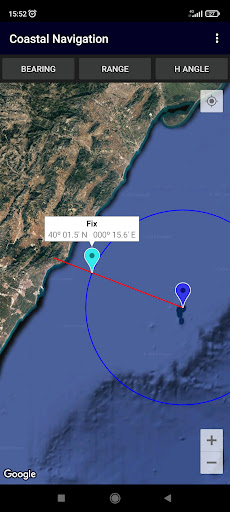
Coastal NavigationLines of position: bearing, range, horizontal angle.Plot on Google Maps.OPERATION-------------------1 - Select the type of coastal line of position: [Bearing], [Range] or [Horizontal angle].2 - Enter its value.3 - (Long click) the point/s of the sight.Then the app plots the LoP on the map.You can check the accuracy of your observations against GNSSPermissions:---------------------- Location App permission must be allowed- WRITE_EXTERNAL_STORAGEMap controls and gestures:--------------------------------------------GPS location- Switch on your GPS, and then automatic location detection is possible- Push My Location buttonZoom- Zoom buttons +/-- Double tap to increase the zoom level by 1 (zoom in)- Two finger tap to decrease the zoom level by 1 (zoom out)- Two finger pinch/stretch- One finger zooming by double tapping but not releasing on the second tap, and then sliding the finger up to zoom out, or down to zoom inScroll (pan)- A user can pan around the map by dragging the map with their fingerTilt- A user can tilt the map by placing two fingers on the map and moving them down or up together to increase or decrease the tilt angle respectivelyRotate- A user can rotate the map by placing two fingers on the map and applying a rotate motion.
Fitness Tracking
Track your workouts and monitor your health metrics.
Travel Features
Plan and manage your travels with ease.
Smart Home
Control and monitor your home with smart features.
See the Coastal Navigation in Action
Get the App Today
Available for Android 8.0 and above